
Boundary Maps
Click on a category below to expand a list of available maps.
- Indiana counties
- Indiana counties with FIPS codes
- Indiana counties and county seats (PDF)
- Google maps by county
- Economic Growth Regions (Dept. of Workforce Development) -- GIF or PDF
- North-Central-South Regions
- Note: State Road 18 divides the North and Central regions. U.S. Highway 50 divides the Central and South regions.
- Realtor Regions (PDF)
- Enterprise Zones (Department of Revenue)
Important to note: STATS Indiana follows the implementation schedule of the U.S. Bureau of Labor Statistics (BLS). New statistical area delineations are not reflected on STATS Indiana until BLS implements these changes into their Local Area Unemployment Statistics (LAUS) program. Learn more about the statistical area revisions »
2023 Statistical Area Definitions 
Analysis: The 2023 metro landscape for Indiana (InContext, Nov-Dec 2023)
2013, 2015, 2017, Apr. 2018 Statistical Area Definitions
Note: No changes were made to any of the Indiana regions during the 2015, 2017 and Apr. 2018 revisions.
2009 Statistical Area Definitions
Related Links
- Statistical Area Definitions (Office of Management and Budget)
- Delineation Files (Census Bureau)
- Historical metro area definitions, 1950 to 2009
What's My District? Find a District by Address
- Find Indiana General Assembly district for a street address
- Find Congressional district for a street address
2021 Maps
- Indiana's U.S. Congressional Districts
- Indiana House Districts
- Indiana Senate Districts
- Shapefiles for the 2021 districts
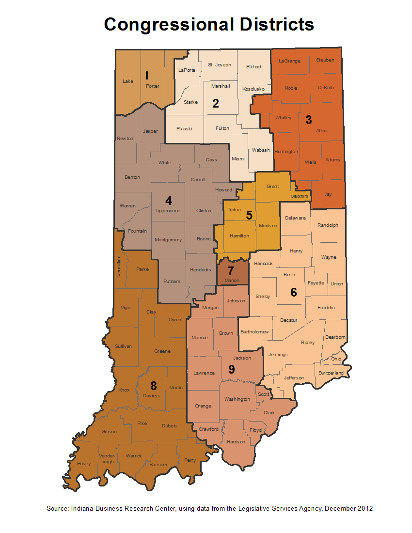
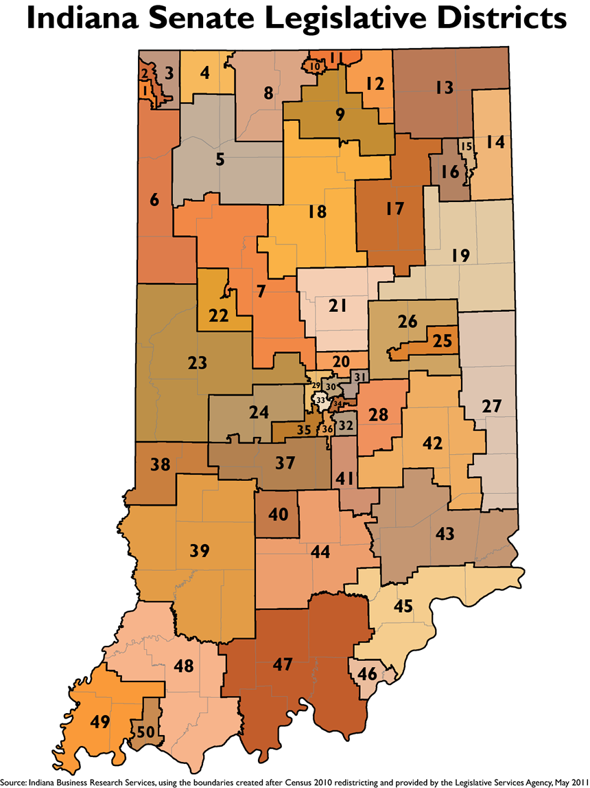
2011 Maps
- Indiana's U.S.
Congressional Districts -- PNG or PDF
- Indiana House Districts -- PNG or PDF
- Indiana Senate Districts -- PNG or PDF
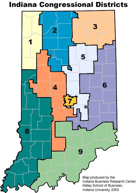
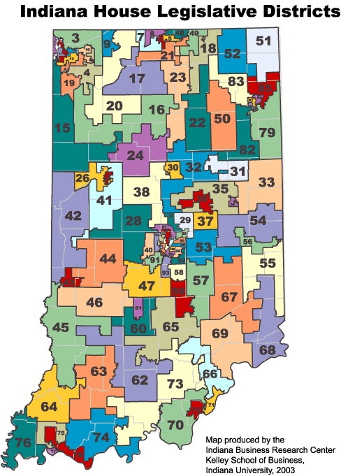
2001 Maps
- Indiana's U.S.
Congressional Districts
- Indiana House Districts -- GIF or PDF
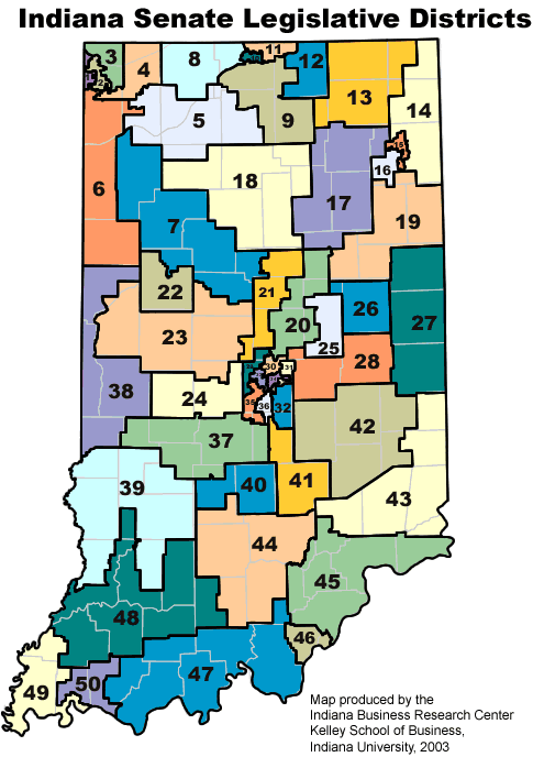
- Indiana Senate Districts -- GIF or PDF
Historical Maps
Libraries and Library Districts
- Interactive Statewide Map (updated quarterly)
Main Library Branches
- Printable Statewide Map, 2024 (120 MB)
- Township Maps, 2020
- Township Maps, 2010
- Township Maps, 2000
- Locate township for a street address
- Section-Township-Range Interactive Map (USGS)
- In the "Add Data" section, select "BLM Public Land Survey System (PLSS)" layer.